As digitization marches forward, one way to modernize your water utility is by adding Trimble systems to your available tools. More than simple location services, Trimble Unity can help save your water utility's wasted time in the field and money in the budget. Here's a quick look at how their system helps you make this happen.
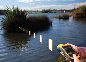
Trimble Unity is an industry leader in terms of accuracy, precision and reliability. This is vital when you're sending a crew out to locate an asset and don't want to waste a lot of time before repairs or maintenance begins. As a comparison, a standard GPS satellite receiver used on a smartphone is accurate to within about 25 feet. Now imagine a circle that extends 25 feet in every direction around you. That's a lot of ground to cover! Trimble Unity can cut that down to six to twelve feet.
As a leader in GIS digitization, its systems work well across a wide range of platforms and compatible products, giving you more options without having to replace existing assets. This makes it much easier to develop a customized interface that ties together all the separate parts of your system without having to micromanage the entire project. You can simply have the interface designed and get back to managing your water utility's daily needs. It also has options available to work with mobile devices, so that you can use existing devices and tools with Trimble Unity's compatible products to get the job done.

Let's look at a water leak or pipe break scenario. Your utility realizes that it's losing water, whether from downstream customers who are reporting poor or no pressure, or from other monitoring in your system. At that point, you can work through the process of locating the leak, sending your crew out to slowly locate the source of the problem. If it's a busy area, you may spend more time trying to work around pedestrians or busy intersections. A lot of extra labor is paid out even as revenues are lost from the outage.
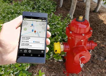
With Trimble GIS, you can avoid virtually the entire scenario. The system will let you know exactly where the asset in question is located, allowing you to avoid costly and time-consuming searches. By glancing at the records, your crew knows exactly which tools are needed to handle the situation. They can immediately start working on fixing the problem.
The high volume and quality of data available from the Trimble GIS system allow you to make smart decisions for your water utility. Analytics allows you to pinpoint the location of a leak. It helps you determine whether new paving projects will interfere with water meters. Being able to quickly and accurately find an asset makes it much easier to figure out exactly how that asset will be impacted by future projects.
With Trimble GIS's products, you can get a quick return on your investment in terms of recovering time and money that would be otherwise wasted in the field. But what if you're not sure exactly which system will work best for your water utility? If you need more information, have questions or want to see what these high-quality GIS systems can do for your waterworks organization, please feel free to reach out to the experts at Team EJP today.